
Northern Colorado Hail Dashboard · Official-source context
Current statusActive Warning

Know what the storm is doing—and what to check next.

1 active NWS alert intersects the Northern Colorado tracking area, including Freeze Warning issued October 16 at 8:40AM MDT until October 17 at 9:00AM MDT by NWS Goodland KS. Radar, warning geometry, and preliminary hail observations are presented together without claiming damage to any specific vehicle.

Geographic calculation anchor40.41566, -104.7721515City reference point only—not a business, shop, or owner address.
Live Northern Colorado View

Radar, warnings, and reported hail—together.

Current NOAA/NWS radar is shown with active warning geometry and preliminary SPC hail reports. Use official warnings for safety decisions.

Current radarNWS warningSPC hail reportService-area reference

Loading current radar and map layers…

Radar shows precipitation reflectivity, not confirmed hail or vehicle damage. Warning polygons and preliminary reports can change. The service-area circle is a geographic reference, not a storefront location.

Alerts1 localNWS feed: Current
Hail reports0 nearbySPC feed: Current
RadarNOAA/NWS MRMSCurrent reflectivity · no animation
UpdatedOct 16, 2026, 6:35 PM MTFeed timestamps remain detailed below.
National Weather Service

Northern Colorado Active Alerts

Official warning geometry is checked against the 50-mile Greeley radius. When an alert has no polygon, its official area description is used as a clearly identified fallback.

NWS · area description

Freeze Warning issued October 16 at 8:40AM MDT until October 17 at 9:00AM MDT by NWS Goodland KS

Yuma County; Kit Carson County; Cheyenne County; Cheyenne; Rawlins; Decatur; Norton; Sherman; Thomas; Sheridan; Graham; Wallace; Logan; Gove; Greeley; Wichita; Dundy; Hitchcock; Red Willow

Expires: Oct 17, 2026, 9:00 AM MT

Official NWS source →

View Broader Colorado Alerts (3)

These active statewide alerts fall outside the primary Northern Colorado view based on official geometry or area description. They are secondary so distant Colorado events do not dominate this tracker.

NWS · broader Colorado

Freeze Warning issued October 16 at 9:53AM MDT until October 17 at 9:00AM MDT by NWS Grand Junction CO

Lower Yampa River Basin; Central Yampa River Basin; Upper Yampa River Basin; Central Colorado River Basin; San Juan River Basin

Expires: Oct 17, 2026, 12:00 AM MT

Official NWS source →
NWS · broader Colorado

Freeze Warning issued October 16 at 5:11PM MDT until October 17 at 9:00AM MDT by NWS Pueblo CO

Canon City Vicinity/Eastern Fremont County; Northern El Paso County/Monument Ridge/Rampart Range Below 7500 Ft; Colorado Springs Vicinity/Southern El Paso County/Rampart Range Below 7400 Ft; Pueblo Vicinity/Pueblo County Below 6300 Feet; Walsenburg Vicinity/Upper Huerfano River Basin Below 7500 Ft; Trinidad Vicinity/Western Las Animas County Below 7500 Ft; Crowley County; La Junta Vicinity/Otero County; Eastern Las Animas County; Western Kiowa County; Eastern Kiowa County; Las Animas Vicinity/Bent County; Lamar Vicinity/Prowers County; Springfield Vicinity/Baca County

Expires: Oct 17, 2026, 1:15 AM MT

Official NWS source →
NWS · broader Colorado

Freeze Warning issued October 16 at 11:26AM MDT until October 17 at 9:00AM MDT by NWS Denver CO

Sedgwick County; Phillips County

Expires: Oct 17, 2026, 9:00 AM MT

Official NWS source →
NOAA Storm Prediction Center · Preliminary

Recent Hail Reports Near Greeley

Reports are sorted by occurrence time and filtered by calculated great-circle distance from the Greeley city reference point—not county name alone.

No preliminary SPC hail reports within 50 miles of Greeley were returned for the current SPC report day. This is not proof that no hail occurred.

A nearby hail report confirms that hail was reported in the area.

It does not confirm that a specific vehicle was damaged. A vehicle inspection is required to determine actual damage.

Weather Awareness

Recent Severe Weather

Active local severe-thunderstorm, tornado, and relevant special-weather statements are summarized here when supplied by NWS. Follow official instructions during dangerous weather.

No active local severe-weather items in these categories are stored. This is not an all-clear; consult the National Weather Service for current conditions.

Reading the Data

Hail Report Details

Location and distance

SPC supplies a reported location and coordinates. Distance is calculated from the Greeley city coordinate using the great-circle formula and rounded for display.

Size and timing

SPC magnitude is converted from hundredths of an inch to inches. Reports follow the SPC report day, which runs from noon UTC through 11:59 UTC the next day.

Preliminary status

Current SPC reports are preliminary observations with varying coverage and precision. They may be corrected and are not a complete survey of every place that received hail.

A · Reported Size

What reported hail size can mean.

Familiar comparisons make official magnitudes easier to picture. Size alone does not predict whether—or how—a particular vehicle was damaged.

0.75″Penny-size

Small impacts may leave no obvious mark or create shallow dents that are difficult to see outdoors.

1.00″Quarter-size

Visible dents become more plausible, particularly across broad horizontal panels.

1.25–1.50″Half dollar to ping-pong ball

Repeated impacts may affect several exposed panels during a sustained storm.

1.75–2.00″Golf ball to hen egg

Deeper dents, trim damage, and glass involvement become more possible.

2.00″+Very large hail

Significant panel deformation and damage beyond paintless repair may occur.

Reported size is context—not a diagnosis.

Damage varies with wind, impact angle, hail density, vehicle construction, panel shape, storm duration, and other conditions.

Read the complete hail-size guide →
B · Real Damage

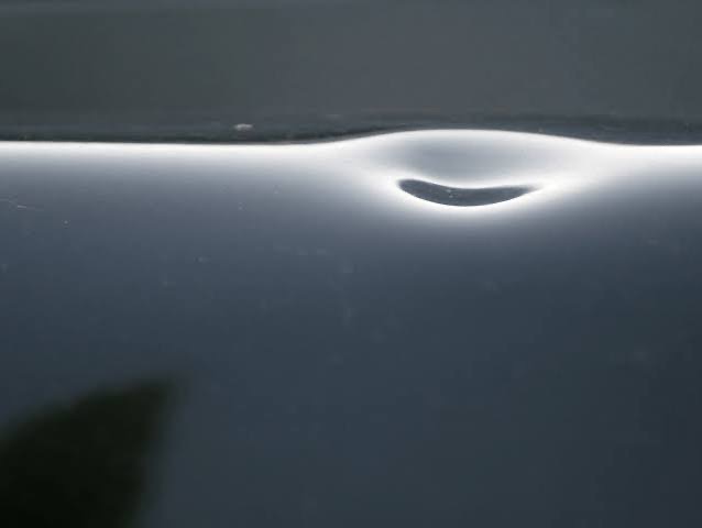
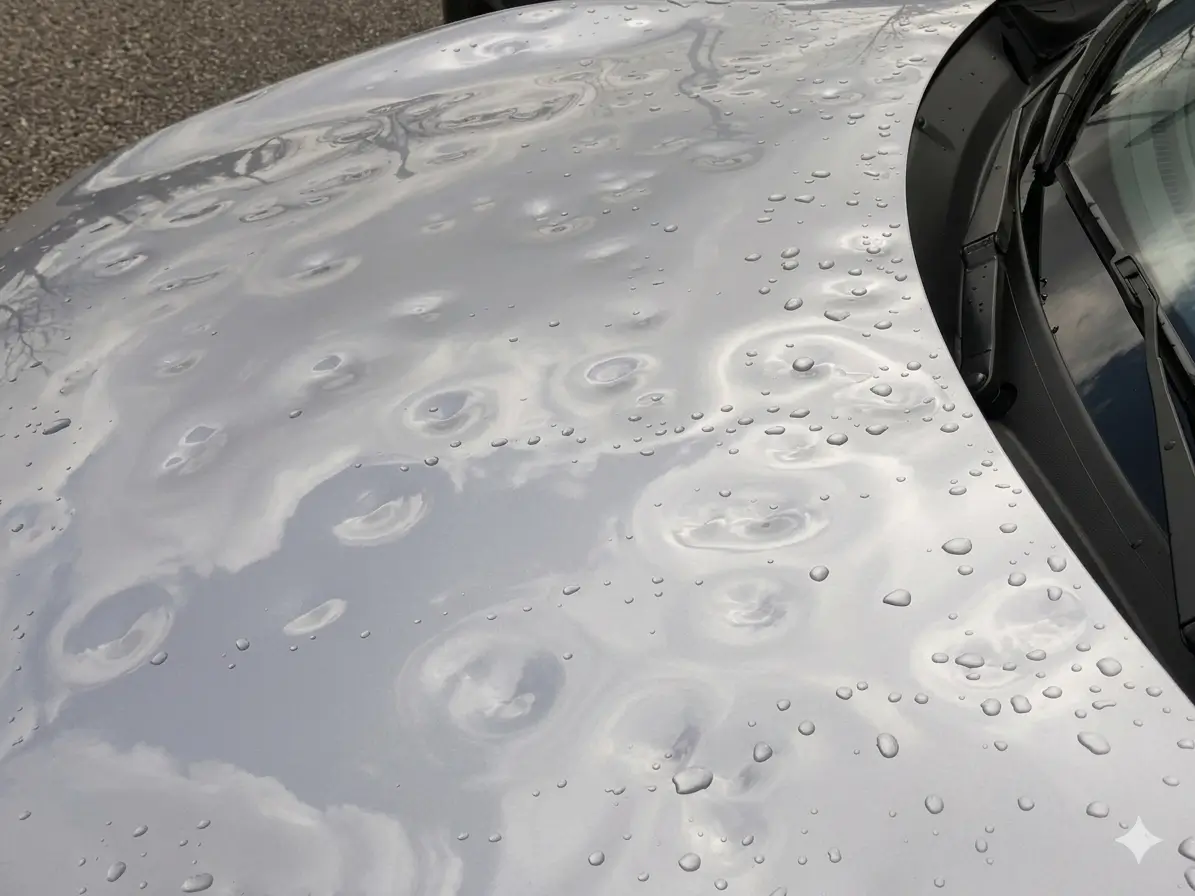
Real examples of what hail damage can look like.

These photographs illustrate a visual progression only. They are not presented as Peak Country repairs or tied to a particular hail size.

Vehicle-specific answers

Not sure whether your vehicle was affected?

Hail damage can be difficult to see without clean panels, controlled reflection lighting, and a direct inspection. Start with a free, no-obligation conversation.

Separate from the Live Feed

Five-Year Hail History

Verified NOAA/NCEI Storm Events observations are presented in the current 2022–2026 five-calendar-year window. The 2026 live season remains preliminary and separate from completed historical records.

Review the source methodology or use the historical page’s stable citation summary.

Explore Northern Colorado Historical Hail →
Source Transparency

Official Data Sources

Active alerts: National Weather Service API

Preliminary hail reports: NOAA Storm Prediction Center

Server cache: Cloudflare D1 retains the last successfully ingested official records. Refresh status and timestamps above identify stale or failed-source states.

Read methodology and limitations →